Search and visualise the Oolite universe with maps and tables. This little program is an exercise in using Swing, and illustrates the use of a clickable canvas and a table with filters.
There are two views, selectable with tabs.
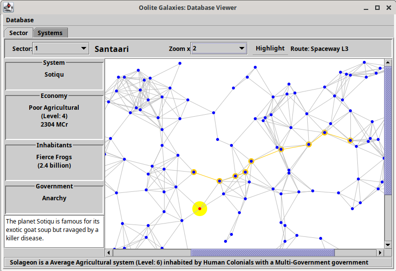
The first tab shows a view of a galaxy sector as a drawn map. Star systems can be selected with the mouse to display some information. The highlight button selects groups of star systems, based on type, region or route.
In the image below, the selected star system (with large yellow surround) has its information displayed on the left. The mouse cursor (not shown) is over a different star system, whose information is showing in the bottom area. The yellow line of selected star systems is the "Spaceway L3" route, selected from the highlight menu.
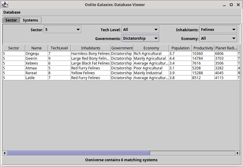
The second tab shows information about the galaxy sector in a table. Filters allow you to select subsets of the star systems.
In the image below, star sector 5 has been selected, and the table shows there are 6 star systems whose feline inhabitants live under a dictatorship.
Download
The zip folder contains the Java source code in a maven project and a compiled .jar file.
The .jar file is compiled under JDK
23, and can be run from the command-line using java -jar
oolite-maps.jar
- oolite-maps-code.zip (date: 2025-01-25)